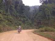
Monday Mar 30th – Today we took a ferry across the Mekong to head due west out to Hogsa, a remote town close to the Thai border. The road was no more than a forest track but the forest was stupendous, think jungle growth that kept us from the heat of the day and as we moved only high ridges up at around 1400m the remoteness of these parts of Laos once again was brought home. While the Chinese might be building sealed roads between the main centres, there remains plenty of true outback in Laos – it has a far lower population density than any of its neighbours. Once we got within cooee of Hogas we decided to push on southward to Sayabouly as this would make the next day a bit shorter and we understood the road was just as undeveloped so 300kms would be making for an impossibly long day. As it happened the tarmac returned once we turned south on the 4a and so we made quick time. Just as well because the afternoon temperatures, now we were out of the forest cover were getting pretty unbearable.
The town is spread out and there’s plenty of evidence of Chinese-driven development going on. They haven’t quite got the electricity sorted though and as we’re scouring the streets for a meal after dark, the power fails and all restaurants are out of action. Fortunately within an hour the town is saved from its darkness and we’re able to get the standard noodle soup and a few more BeerLao to wash it down.
Tuesday Mar 31st – onward to Pak Lay on the banks of the Mekong and our southern most point on this western bank of the river before we head east to Vientiane . The road is now sealed apart from one stretch which made the 200 km achievable by 3pm when the heat is at its height. The battery on Dave’s bike is struggling but Joanne’s spare is keeping him going. He’s hoping to make it through to Vientiane where he figures he’ll get a better range of options for a replacement. Pak Lay is very pleasant on the banks of the mighty river and we find a guesthouse that has our essentials – bike parking, aircon and wifi. All for $12 we are getting pretty keen on Lao prices. These $10-$15 rooms in digs that are no worse than your average IBIS back in NZ, are a real bonus for touring Laos.
Once the heat of the day has gone off we crawl out of our digs and across the road to the riverside bar and restaurant for one of the best meals we’ve had on the road so far – bet Tom Yum anyway and fired vegetable dishes to go with it. Big price of $4 per head for all we could eat. There’s a volleyball match on in town and so the local park is packed with a crowd roaring its approval or not at each point scored. Don’t think they could have played this during the middle of the day. In fact come to think of it, virtually everyone is sheltering inside during the sun’s peak time – meaning our lack of courage to face the midday sun is not just a tourist thing. Dave’s bike still struggling.
Wednesday April 1 – On the road at 6.30am as we again are determined not to be caught out in peak sun. 6kms south of town the bridge across the Mekong is supposed to be – it has been signalled for the last 100kms as the ‘Mekong Bridge’ even though our GPS map is indicating another ferry crossing. The GPS is correct – the bridge is still very much in the construction phase so we are left to await the awakening of the ferry captain who is in no hurry to start the days operations. 7.30am on the dot he starts it up – so we’ve lost an hour already.
The road on the east bank for the first 60 kms is mountainous but reasonably quick as it’s sealed – sort of. We stop for brekky and Dave’s bike finally dies properly. Turns out his battery is completely starved of water so after refilling it, he suddenly has a circuit again and all is restored. Road now turns to unsealed but condition is fine for the run towards the capital. Then it transforms to Chinese superhighway – which seems like overkill given how light the traffic is. While across the Mekong we can see the traffic of Thailand, on the Laos side conditions are light.
We work our way into the centre of town and find digs at the Mixok Inn, which again for NZ$20 we get an IBIS level room – including breakfast.
Thursday April 2nd – Rest day in Vientiane today, time to do oil changes on all 3 bikes, plus weld a crack in the pannier frame on Gareth’s bike as well as fix a puncture Joanne’s bike suffers on the way t the workshop. After that effort its back into the air conditioning to recover from the crazy heat. It’s not until 5 pm that conditions are humane enough for us to emerge and stroll the town before settling down to a few beers and an Indian meal.
All in all we haven’t been that enamoured with Vientiane as a destination. Cities generally bore us but this one is even more featureless than normal. Beyond restaurants, bars and shops selling mass produced Chinese junk, there is not much to see. Happy to move on.
Friday April 3rd – Good Friday – 150kms north today to Vang Vien, a tourist stopover near limestone cliffs, tunnels an rafting rivers. For us the ride was pleasant – so nice to be back amongst the villages. Vang Vien is the springboard for our ride tomorrow to the Long Tieng airfield where the CIA and the Airforce’s Ravens Division conducted the “Secret War’ in Laos against the Ho Chi Minh Trail.
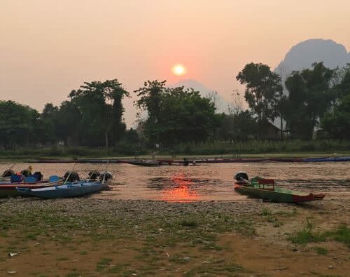
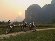
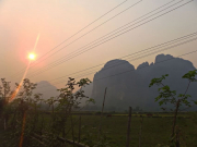
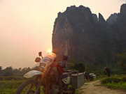
Main attraction in Vang Vien seems to be caves and river rafting. The karst outcrops are spectacular, several hundred metres high and home o the sinkholes and caves. Our hotel is on the river and looks straight at the outcrops so it’s a good location. We eat in town – which consists of a string of bars and restaurants, motorbike and bicycle hire shops and adventure sales desks. For a nice change we get Mediterranean food but it’s an early night as we have an early start and huge day tomorrow.
Saturday April 4th – the big day commenced with a 6am start up of the bikes. It’s a 230 km run up to Phonsavan via Long Tieng and the Plain of Jars. The tarseal runs out after 15kms and the road gets more and more challenging. We’re only half expecting to get to Long Tieng as it has been a prohibited area as late as 2013 because of automatic weapon-carrying Hmong hilltribe insurgents who have been ambushing buses and firing on workers at the Australian-owned copper and gold mine that’s a couple of hours south of Long Tieng. The Hmong and lowland Laotians have long been enemies.
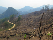
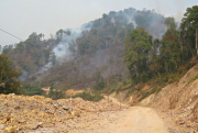
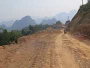
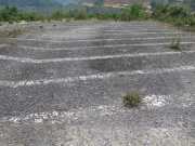
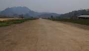
We are waved through our first military checkpoint and the second has the barrier down but is unmanned so we ride around the barrier and carry on. The road reduces to a jungle track and there’s no traffic so we are pretty nervous but press on. After about an hour we emerge from the jungle on to a new road construct that is still being intensively worked on by road gangs. At least there are people around now and they’re not waving us back so we press on. At midday precisely we ride down into the Long Tieng valley and there’s the runway – the CIA’s most secret place on earth has been revealed to us. We’re ecstatic and get the mandatory photos and poses in front of the karst outcrops at the end of the runway affectionately known as the “vertical speed brake”. It’s hard to believe that once there were 50,000 people here – Americans and Hmong tribesmen all fighting the Vietcong and Pathet Lao – and that by the mid-1960s it was one of the busiest airports in the world as the Americans sought to bomb the Ho Chi Minh Trail out of existence.
For more on the CIAs secret war in Laos be sure to view the doco on https://www.youtube.com/watch?v=ye2rzEKbz8I
We managed the first meal of the day at the standard rustic Laotian roadside café – noodle soup never tasted so good. We then set off to cross the Plain of Jars and spend the night in Phonsavan. Then I had an involuntary dismount and as always seems to happen the right leg got trapped under the pannier and by the time I extricated it and determined I hadn’t broken the ankle but it would be swelling and remain pretty sore, Joanne and Dave were on the scene for the obligatory photo and to help strap it up. The accident was just the standard front whell tuck under that can happen if you take you mind of the job for a second or two and find your front wheel in a hard caste mud rut when you’re trying to turn and going a little quick,.
But it made for a painful rest of the day for me as I limped the remaining 80 kms north to our overnight stop.
Sunday April 5th – the day started late as my swollen ankle, foot and leg meant that I was in no great shape to go biking. But after a lie in and late start for us (10 am) I was into it and off we set. But the day was frustrating – our guesthouse host had told us that the best road south (I’ve had enough for rough roads until this swelling goes down) was t take the 1D south for 200kms until in joined Highway 8. He was wrong. 50 kms south the road turned to trash and we were told it was like this for the remaining 150 kms. That was no good for me, our fuel was also low as we’d thought that being the main road there’d be plenty of gas supplies. But the population is sparse, the traffic basically non-existent.
So we did a U-turn and headed back to Phonsavan for another night and planned for an early start tomorrow to take the alternate route. A lesson learnt here – the Laotians don’t use maps generally and their difficulty in reading and interpreting ours was a case of the blind leading the blind.
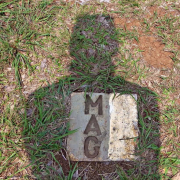
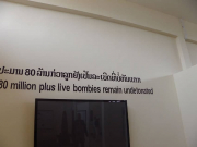
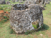
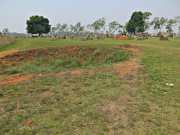
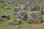
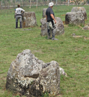
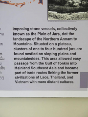
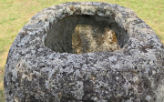
Still amongst all this we did get to visit one of the historic sites of the Plain of Jars and it was great to both see those ancient constructs from some 2,000 years ago – as well as walk between the bomb craters that are an legacy from the carpet bombing the Americans carried out here in the efforts to remove from the sky, everything that moved below. Disgusting.
Monday April 6th – headed down to Pakxan on the Mekong the “correct” way today. 230 kms of relative straightforward road, albeit 80 kms of horrible roadworks in the middle. Dropping from 1200 to 150m altitude means the temperature soars again making afternoons on the bike pretty unbearable. We set off at 6.30am so were able to crawl inside by 2pm. By getting south to the Mekong we can now spend the next 3 days following it until we hit Cambodia this Friday where we’ll leave the great river and head west to Angkor Wat.
Tuesday April 7th – 190 kms down Highway 13 to Tha Kek. An easy day and a relaxed destination on the Mekong. Dinner was at the Smile Boat looking across at Thailand.
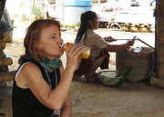
Wednesday April 8th – 6am start of bikes to do most of the 330kms to Pakse before the heat goes mad. Progress is great, first 100kms takes 1.5 hrs, next hour knocks off 60kms, so we’re 200kms in by 9am. Road is superb, huge contrast to further north although we did go out of our way to find mountain tracks. 2 stops for food and 3 rests all we great interaction with the locals. We’re still very much a novelty in these small towns and hamlets. People are shy but engage once you engage them. Some just can’t deal with the lack of any language but most don’t mind that at all, photos of grandkids and us cuddling their kids always works a treat.
Thursday April 9th – to Khong Island today, middle of the Mekong in its widest section just north of the Laos/Cambodia border. Ride is only 137 kms so latish start (8am) as we reckon we can dodge the worst of the heat. The GPS is telling us to catch a ferry but the road leads on past the turnoff with signs saying Khong Island is straight ahead. Dutifully and dumbly we follow the GPS guidance down a goat track that eventually gets to a ferry landing. But there, a mere 500m down the river is a stupendous bridge that , we find our as we cross it, was just finished in 2014 by – yes you guessed it – the Chinese.
The island hamlet of Muang Khon is pleasant enough on the banks of the Mekong with plenty of accommodation and restaurant choices. The fisherman are working their nets hard but from what we can see not catching much. The farmers are all sheltering from the sun underneath their pole houses. Until the rains come they can’t do much now.
Friday April 10th – 60 kms to the Cambodian border and we reach it before 9 am, have a quick feed to try and jettison some more Laos kip before we have to deal with Cambodian riel. The Customs official demands our carnets. I point out that his isn’t a carnet country so he’ll have to be happy with our NZ rego papers and authorise a temporary import. His reply is he can’t do that and one of us will have to take the bus down to Pnom Penh and get an official invitation for a temporary vehicle import licence. Since its 300 kms and probably a 3 day round trip we surrender and produce our carnets. Quick as a jiffy the motorcycles are authorised and we’re free to go.
And just to think I wasn’t going to bring carnets on this leg since none of the countries are carnet members. The 180kms road through to Preah Vihear are on perfect roads (Chinese?) although it is clearly frontier country as the roadsides are line by new wooden pole houses and occupied by farmers all of whom seem to own a Chinese tractor (rotary hoe). Behind their small plots along the roadside though there are some extensive planted fields that are clearly the work of corporate farmers. So it’s all go here.
Preah Vihear is a grubby little service town and although it has limited to no tourist-oriented guest houses and restaurants, we are introduced to the Cambodian two tier pricing structure where everything has a US dollar price as well as a Cambodian Riel price – and the conversion is nowhere near the exchange rate, the tourists expected to pay substantially more for everything. On top of that there is also substantial markup asked and so bargaining has to occur. Joanne is aggressive in this department and we soon learn that each transaction is going to take 4 times as long as normal as whe wears down the vendor.
The food in the town is rubbish, the beer is mainly warm. So we organise some cold beers, buy a couple of chickens and eat in our hotel room which is the cleanest place we can find. We decide on an early night as we want to be on the bikes by 6.30 am for the ride down to Siem Reap.















Comments are closed.